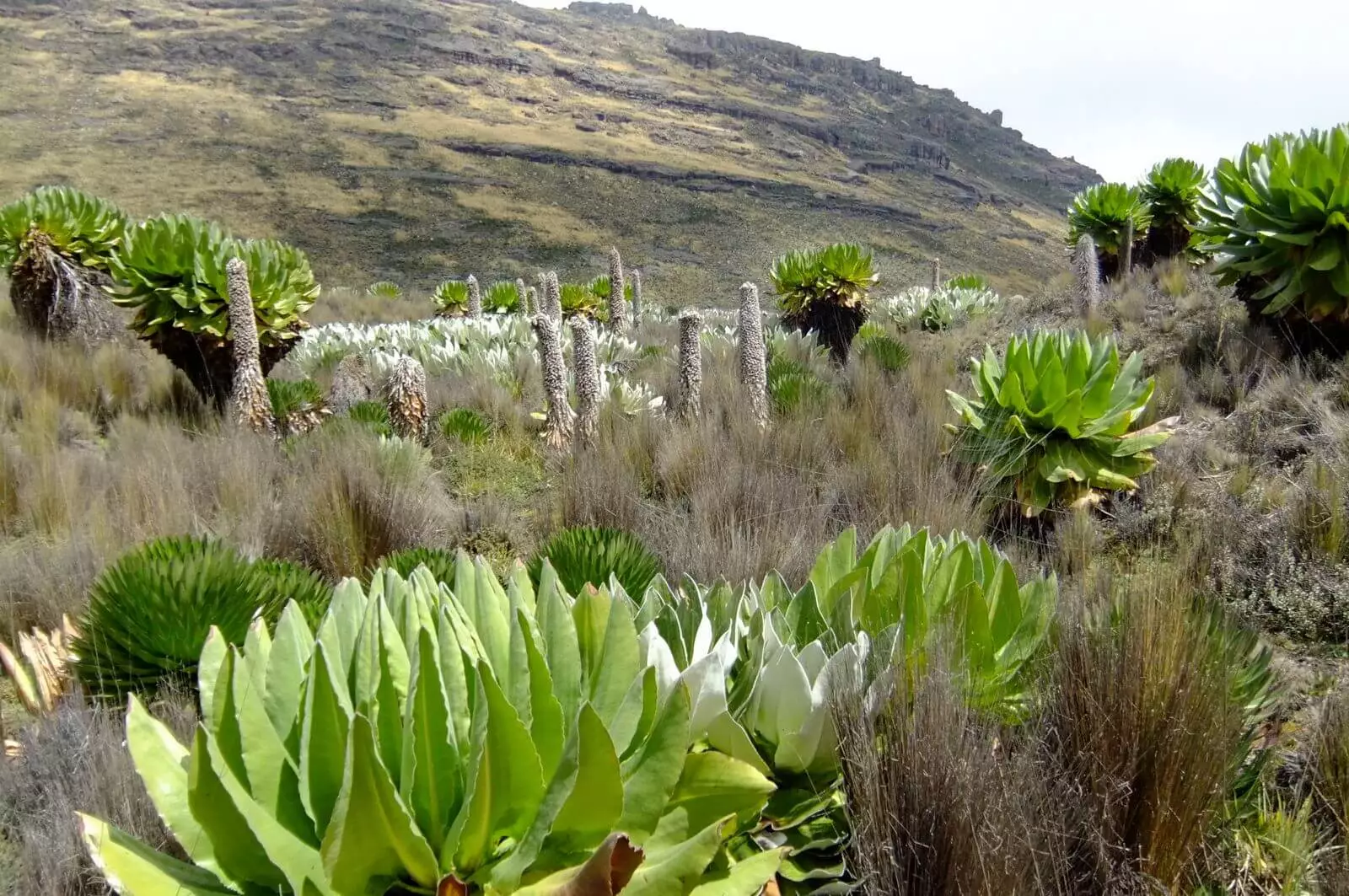
Mt Kenya is an extinct volcano with three jagged peaks rising to 5,199m/17,057ft. It offers beautiful forests and moorlands and a very beautiful climb.
Located in central Kenya, just south of the equator, around 150km/95
miles north-northeast of Nairobi, Mount Kenya is an extinct volcano with
jagged peaks rising to 5,199m/17,057ft. If climbing Kenya’s highest peak and the
second tallest one on the African continent is not yet on your list of
mountains to climb, it definitely should be. From the summit, you get excellent
panoramic views of the Kenyan plains and the other mountain peaks
surrounding the Rift Valley.
Mount Kenya actually has three peaks:
Batian, Nelion and Point Lenana. All of our treks ascend Point Lenana, the lower of the three which can be reached without technical climbing.
So you probably have a lot of questions, like "When is the best time to climb Mt Kenya?" "Which route should I choose?" How difficult is Mount Kenya? " "How long does it take to climb Mount Kenya? "What are the routes on Mt Kenya and how do I choose one? " For these and more read more here.
There are 3 principal summit routes , namely Sirimon, Chogoria and Naro Moru. These can either stand alone, or together as variations with other routes. We recommend doing the trek by ascending and descending each of the routes to give some variety, and mix up camping or staying in huts along the way.
It is the fastest route to the trekking peak at Point Lenana.
Approach is from the west.
Starting altitude is 2400m.
There is a steep section of vertical bog
The Chogoria route approaches
from the East.
The route is
often described as the most attractive route on Mount Kenya.
There are huts except at high camp where tents are used.
The Sirimon Route starts from the North West corner of the mountain
The route is usually considered one of the easier routes as it climbs
relatively gradually with only a couple of steeper sections to reach the
top camp.
There are huts along the way.
Route combinations offer a greater vaierty of scenery by ascending one route and descending another.
Sirimon - Naro Moru Traverse
Sirimon - Chogoria Traverse
Mt Kenya comprises three peaks, two of which are technical climbs and one which is a trekking peak. The two major technical rock and ice climbing peaks are called Nelion and Batian. The third peak is known as Point Lenana and is a trekking peak, easily achieved via hiking or walking. Our Mt Kenya treks all go to Lenana, so our tours are to the trekking peak where no technical expertise is needed.
The highest peaks of the mountain are Batian 5,199 metres (17,057 ft), followed by Nelion 5,188 metres (17,021 ft) and finally Point Lenana 4,985 metres (16,355 ft).
The shortest number of days required to climb to Lenana on Mt Kenya is three days. The longest trek is around 6 days. It all depends on which route you choose. As a general rule of thumb, any trek where the ascent is very quick makes the overall success rate, lower, so it is better to add on extra days to increase your chances of success.
• The following are the major and frequently used routes:-
• The Chogoria route leads from Chogoria town up to the peaks circuit path
• The Naromoru route is taken by many of the trekkers who try to reach Point Lenana in a few days.
• The Sirimon route approaches Mount Kenya from the plains in the Nanyuki Timau area on the north-west.
The warmest months with the clearest trekking days, are from mid to late December, January, February, September and October. The rains often come in April and the start of May with the possibility of some snow. June through to August are superb trekking months, though evening temperatures tend to be colder. The wettest months are November and early December, where snowfalls are likely. Note however, that as this is a mountain it is not impossible to get sporadic snow or rainfall at odd times throughout the year, although the snow normally only falls above 4800m.
This is a really difficult one to answer directly - "how will I cope with the altitude". To be honest, this is an ' unknown' factor as no-one can predict how your body will cope at altitude. People who have been to altitude many times in the past without problems, may on one climb suddenly develop problems. There are many factors that play a role. The only way to help combat this, is to take all of the necessary precautions, and walk slowly, pole pole.
If you are going hiking or climbing or trekking then you need extra cover for your activities. Hiking and Climbing have become popular for many adventure seekers looking to add a climb up Kilimanjaro or a trek to Everest Base Camp, Annapurna or even Island Peak to their list of amazing adventures. But any climb to high altitude carries with it a number of risks and having the correct and good trekking insurance is an absolute must. We recommend two different groups depending on whcih contry you reside in. For further details, click on the icon
Altitude is much like elevation only it refers to the distance measured
above a specific planetary point, and in most places, this is the
distance above sea level. So if we live at the sea, how do we train for
high altitude? Getting technical about O2 and altitude At sea-level, the
concentration of oxygen in … Continue reading
The terms seem to be used interchangeably on many websites and travel books. It becomes even more confusing when some companies sell their boots as 'trekking boots' and then proceed to state that they can be used on long hikes. And when is a walk a trek and when is it a hike? It becomes … Continue reading
these boots are made for walking
Kilimanjaro, the Inca Trail, Everest Base camp or a simple short hike on local trails. We all dream of these amazing places and for some of us, turning those dreams into a reality is like a brand new lease on life.
Continue reading